 |
|||
 |
 |
 |
|
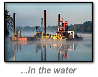
Hydrographic Surveys
|
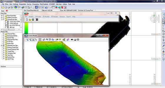
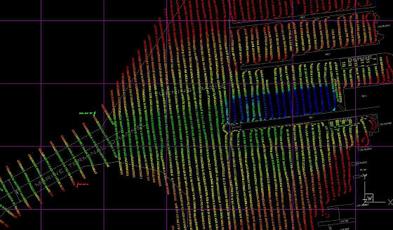
Our expertise and experience can assist you in keeping our beaches, communities, waterways, and marine infrastructure safe. GEOmatx offers a wide range of hydrographic services in support of various types of marine design and construction projects. Utilizing the latest state-of-the-art equipment, careful consideration is given to the critical success factors that will ensure accurate, high quality survey data while maintaining the highest possible regard for the health and safety of those involved. Our survey procedures have been developed based on International Hydrographic Organization (IHO) and U.S. Army Corps of Engineers standards, combined with our own survey experience and are constantly reevaluated based on the latest safety procedures, scientific technology, and equipment advances. With the ability to record both “hard” and “soft” river and sea beds, our dual frequency echosounder system is a state-of-the-art hydrographic survey system that can also be mounted on almost any vessel of opportunity. Using HYPACK software, the industry standard, information is displayed and recorded on a laptop computer in real-time. Our 4.5m hard-bottom Zodiac inflatable is a rapid response and low cost survey platform uniquely suited to surveying the shallow back bays, waterways and small harbors around the Chesapeake Bay. Our 22 ft. C-Hawk Pilothouse workboat allows us to conduct surveys in more open, exposed waters and marginal weather conditions. They are both equipped for coastal navigation with a GPS chart plotter, depth sounder, marine VHF radio and all required Coast Guard safety equipment. GEOmatx’s on-board RTK GPS system provides a real-time XYZ-positioning component that eliminates data errors caused by heave, pitch and tides while reducing many post-processing requirements. We believe this combination is the most advanced way to obtain quality, motion compensated, single beam data in depths as shallow as one foot in the surfzone, shallow inlets, channels, or estuaries. After the field data is collected, our trained staff will examine the data for quality and prepare a deliverable. Deliverables can be in a variety of CAD or GIS formats or can be provided in hardcopy. At our client’s request, we can provide reports documenting the procedures used to collect and reduce data. We are flexible and willing to work with you to provide your data in the format best suited for your needs. Our hydrographic and bathymetric survey capabilities include: |
|
|
• Single Beam, Multi-beam and Side Scan Surveys |
|
| GEOmatx’s ZODIAC is available to satisfy the requirements of OSHA regulation 29 CFR §1926.106(d) which states “at least one lifesaving skiff shall be immediately available at locations where employees are working over or adjacent to water." We can provide a manned, inflatable boat for short- or long-term projects to help protect employees involved in inspection, construction or repair work where drowning could occur if other protective measures fail. ZODIAC inflatables have long been used by First Responders for search and rescue operations. Ours is also equipped with a Yamaha/DURA-JET motor which has no exposed prop that could further injure individuals during a response. Contact us to further discuss your project’s needs. |
 |
Home | Hydrographic | Land | Telecommunications | Projects | Contact Us
Copyright © All Rights Reserved.
![]()
443.562.7136
survey@geomatx.com